Specialist Services
Back to HomeIn addition to our core surveying services, we provide specialist services for projects with more specific requirements, supporting planning and design across a range of project types.
Land Surveying and Mapping Services
In addition to our core surveying services, we provide specialist services for projects with more specific requirements, supporting planning and design across a range of project types.
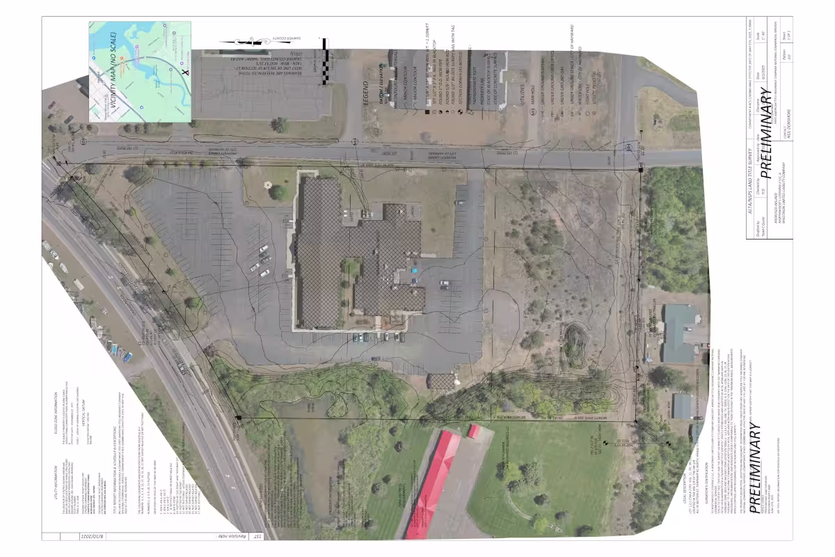
Our aerial, topographic, and satellite mapping services provide high-resolution data and imagery for planning, design, and analysis. Perfect for large-scale or remote projects, we capture the details needed to make informed decisions and streamline your project workflow.
We create sustainable and functional trail designs, combining terrain analysis, environmental considerations, and accessibility requirements. Whether it's recreational, educational, or conservation-focused, our trail surveys help ensure safe and enjoyable experiences for all users.
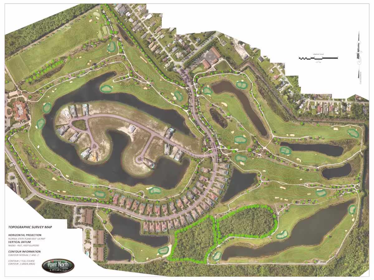
Using advanced 3D surveying and modeling, we provide detailed golf course layouts, terrain analysis, and design support. Our services help architects, course managers, and developers optimize playability, aesthetics, and construction efficiency.
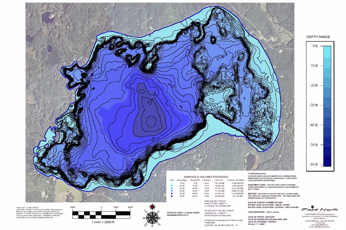
With over 15,000 lakes in Wisconsin, bathymetric surveys are essential for understanding underwater terrain, measuring depths, and generating detailed charts. Our team delivers precise mapping for navigation, environmental studies, recreational planning, and commercial water projects, providing safe and reliable results across the region.